

Case study
Jigeen Maps
An app built so that travelling alone does not mean improvising your own safety.
A personal project by Véronique Marro, designed and built end to end: the interface, the server, the database and the mapping.
The origin
The starting point
I often travel alone, and the same question keeps coming back: where can I go and feel safe? It is not a question that only arises abroad. It arises at home too, in your own city, outside a place you have never been: a restaurant, a bar, a street, a neighbourhood. Alone, in pairs or among friends, you hesitate, you ask around, and sometimes you give up.
Women's safety in public space is a reality in every country in the world. It is a subject that calls for concrete answers.
The project
The answer
“Jigeen” means “woman” in Wolof. Jigeen Maps sets out to be one of those concrete answers. It is a collaborative map of the places where women feel safe, added and rated by women who have genuinely been there. Travelling or close to home, it helps each of them choose where to go, with confidence.
What the app does
- An interactive map of the places found, filterable by city and by use
- Places added by the travellers themselves
- Reviews and ratings shared by the community
- Several destinations, from Senegal to France
Trust
A responsible approach
An app built for women's safety has to be a place of trust first. Behind Jigeen Maps, a team of moderators keeps watch every day: every sign-up is verified, including through a selfie checked by a person, and content is moderated. No user gets in without being verified.
The app never tracks its users' location: any location sharing stays voluntary and approximate.
And this is only a glimpse: Jigeen Maps holds plenty of other features, to be discovered at launch.
In pictures
A glimpse of the app
The app is not open to the public yet: here are a few screens from the version in progress.
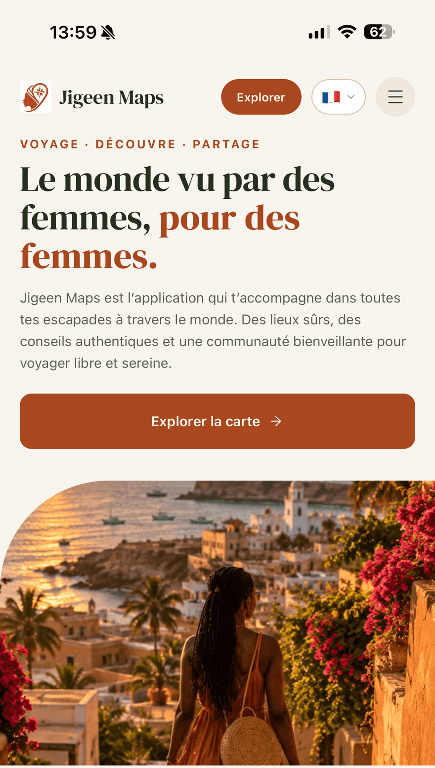
The home screenThe way into the app, and direct access to the map. The mapThe places found, city by city, with search and filters. 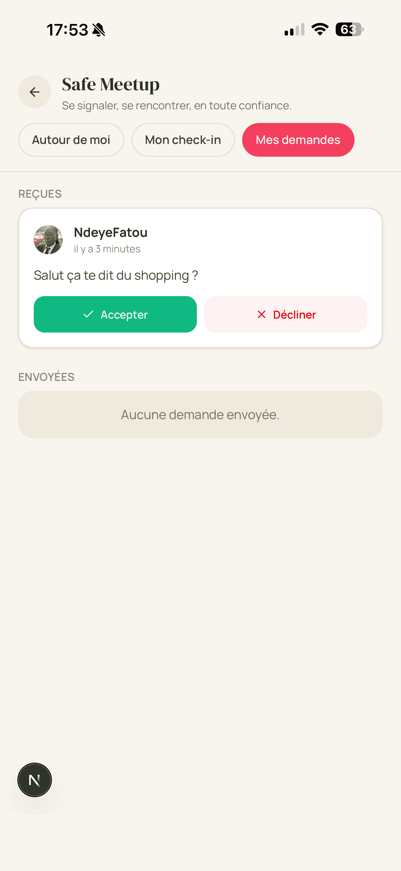
Safe MeetupMaking yourself available in an area and answering requests, while staying in control. 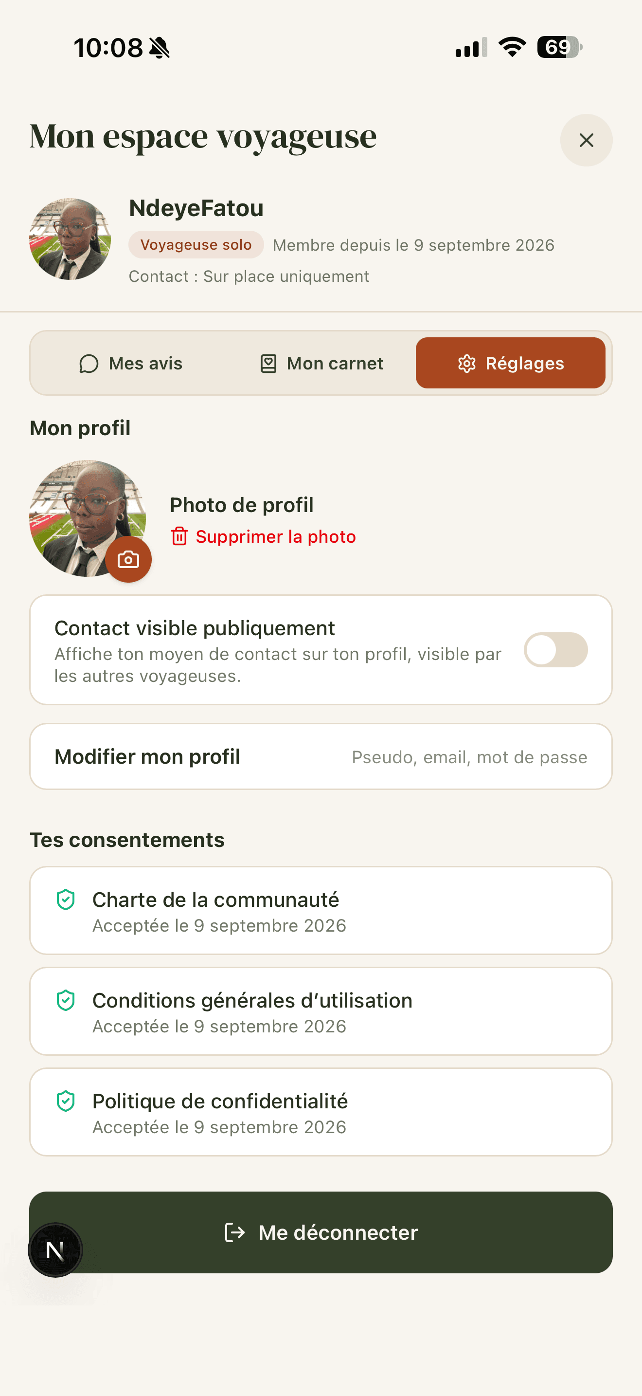
The traveller's spaceProfile, reviews left, settings and dated consents.
Screenshots of the version in development, with demonstration data.
Under the hood
The technical choices
One person across the whole chain: tools I know well, and that hold up without a team to maintain them.
- Interface
- Next.js 16, React 19, TypeScript, Tailwind 4
- Mapping
- MapLibre GL
- Server and data
- Node.js, Express, Prisma, MySQL
- Image storage
- Cloudflare R2
- Hosting
- Hostinger
What this project demonstrates
Three things, concretely
Built solo, end to end
A complete product, carried alone from end to end: design, interface, server, database and go-live.
Installable, and map-based
An app that installs on a phone, without going through the App Store or Google Play, with a smooth interactive map.
Built around trust
A design built around trust: verified sign-ups, human moderation by a team of moderators, and privacy considered from the start.
Where the project stands
In its final phase, beta testing in preparation
The app is in its final phase. Beta testing is being prepared (November 2026), ahead of a gradual opening, city by city, starting with Marseille.
Something in mind?
Let's talk about your project
Describe what you need in three minutes. I study every request before we speak, so that what I suggest genuinely fits.